Friday, July 10, 2015

7/2/15 On the road from Whitehorse, YT to Skagway, AK

7/2/15

On the road to Skagway, AK from Whitehorse, YT


Emerald Lake, not far out of Whitehorse on the Alaskan Highway. The picture doesn't do it justice, and it was cloudy, but the name Emerald is because the water is a beautiful green.
A bumpy landscape of rocks around the Emerald Lake. Just on the other side of the ridge, the sun shines on more rocky slopes.
The changes in the weather patterns,  and insect infection is affecting the food sources for the wildlife, which changes the natural food chain as animals move from area to area trying to keep up with their food source.
 Whitehorse at the top of the map, Skagway at the bottom, and where we are is not quite half way through the day.
 A typical tourist trap, the false fronts have nothing behind them but the animal displays. This is Caribou Crossing (the picture is mislabled...my error)
 The sheep on the mountain above the buildings
were fake, but the state bird below is a reasonable likeness!!

 Well, come right out and say it...don't most people ignore most signs??? Like, doesn't apply to them, right???

STILL haven't see a real MOOSE!!!!!


Wood decked bridge...very noisy !!


Sure wish it hadn't been so cloudy, sure takes the color out of the lakes and rivers!!


No room for error here!!


What's a travel day without rain??


 Heavy fog is not a fun way to go down an 11% grade, but at the bottom of the hill is Skagway, Alaska!!


I was wishing the markers had lights on them so WE could see where the road was!!!


Thursday, July 2, 2015

Watson Lake, Yukon--Days 14 & 15 of the Caravan

As we pulled out of the Liard Hot Springs Campground, we came across a few of the local Bison herd grazing along the road. The guy in this car was taking pictures of this big guy as he crossed the road, then got behind the car. From our vantage point, it looked like he was going to push the car down the road...forcefully! The driver finally hit the gas and got away from the Bison, which was about the same size as the car!
 Pretty mangy uh? A little slow at losing his winter coat.
 Mama was walking along, completely ignoring her baby, who kept trying to nurse.
It was a good day for viewing wildlife, this big black bear was one of many we saw along the road.
 The Upper Liard River
Grizzly Bear or Brown Bear?? He was grazing just down the road from a small heard of Bison, don't think either knew about the other.
 We have entered the Yukon at last!


And then, Watson Lake, our destination for the next couple of days


 Downtown RV Park within walking distance of the Northern Lights Center where we watched a film about the Northern Lights.

Across the street from the Northern Lights Center is the famous Sign Forest.

The first SMART Caravan Sign

 Phil puts up the Northern Exposure Caravan Sign, just a couple of posts down from the 1st SMART Caravan sign. It was a proud moment for him, he and our friend, Rick VanNorman designed and made the sign (I painted it)

It's up!! We were going to put the sign up on our way back through Watson Lake in August, but we found out that they only budget so many posts a year, so we decided we had better get it up while there was a place to put it.
 All of us signed the back of the sign

We will check it out when we come back in August to see how it is holding up

Liard Hot Springs Campground, BC--Days 12 & 13 of the Caravan


 On the road to Liard Hot Springs Campground, in Liard River. These bump signs are everywhere, sometimes they are very serious, and sometimes not, so we always slow down, just in case.
 We pulled off at this little spot in the road because they had been advertising the last few miles that they had the best Cinnamon Rolls. We also found fuel, so some of our group filled up while we were there. They were warm out of the oven, and huge. Phil and I shared one after we got back on the road, I had to feed it to him while he drove because it was sticky, gooey delicious!!!

 The Stone Mountain Range, where the tree line is obvious!
 This plaque tells the story of the mountain in the following picture. It is very aptly named!!
 You may want to enlarge this picture to see the 'folds' more clearly. It was the strangest mountain we had ever seen!
 Our approach to Muncho Lake, BC. This lake was so still, it was just like glass when we were there. Pictures do not do it justice! It is a beautiful green colored lake, which is caused by the copper in the water, from the run off from the surrounding mountains.
I call this Phil's Ink Blob, but it is actually the perfect reflection of the mountains in the water of Muncho Lake.
Mountain Rains roll in over the mountains.
 At the Liard River Campground, this is the resident Bison. He wandered in late one evening around 9:00 pm, to eat his fill on the grasses around the edges of the campground. He was an older guy, but obviously use to crazy tourists taking his picture, as we were all out there with shutters snapping while he munched away.
Our rig at the Liard Hot Springs Campground

Travel to Fort Nelson, BC--Day 11 of the Caravan

 As we were leaving Dawson Creek we passed this couple on their bikes. Not my idea of a fun trip, but we have seen a lot of like minded people traveling the roads up here!
 One of the longest bridge spans on the highway, this one spans the Tetsa River. Also seen are the ever present road construction crews, they work all summer...it can't be done during the winter!
The metal grated deck of the Tetsa River Bridge, makes a horrible racket when you drive across it.
 We have seen a lot of these Moose caution signs, but...NO Moose!!!
Above the ground...and the road...gas pipe lines. These were just south of our destination of the day: Triple G Hideaway in Fort Nelson, BC

Dawson Creek, Days 7-10 of the Caravan

At last, after all the planning, we arrive in Dawson Creek where Mile 0 of the Alaska Highway begins. We were here for three nights, where we celebrated Dad's day with cake, had a talk from the director of the visitor's center about the history of the building of the highway, and then had a group picture taken at the Mile 0 sign. Do you see us??? Oops, I think we are invisible! The group shot was taken by our caravan photographers, so I don't have a copy of that yet.


The original highway included this hill, which was just north of Dawson Creek, and was quite hazardous. It became dubbed 'Suicide Hill' and a sign was placed at the top of it, 'Prepare to Meet Thy Maker'.

Just before arriving at Dawson Creek, the sun produced some pretty powerful flares and it was reported that we may have a chance to see some of the famous Northern Lights. Phil and I stayed up late for it to get dark enough to have a chance to see them, which finally happened about 1:00 am. We did see some faint green wisps of light, but nothing dramatic like you see in the pictures. It was very disappointing, but given the time of year we are here, the lights are not usually visible at all. Guess I shouldn't complain, uh?

Whitecourt, AB Day 6 of the Caravan

We spent the night of June 18th in Rocky Mountain House, AB and then headed to Whitecourt, AB the next day. Roads are good, some trees but mostly farm country.


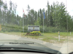
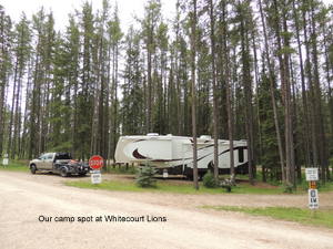
 We arrived at the Whitecourt Lions Campground on June 19th. There are lots of Lions Campgrounds in Canada, they use the proceeds to fund their projects. The campground is nice, each site sits individually in the surrounding trees.  Shortly after we arrived it started to rain, and continued to rain for most of our one day stay.
 Phil and Nita present a certificate of appreciation for going above and beyond to make our stay as great as possible. Even though we were only there for one night, our hosts, Lena and Don arranged for some of our group to tour the local Saw Mill, then we were to have a pizza party (that the caravan paid for) in the Rotary Park, complete with a visit from the Whitecourt Mayor.


The rain didn't let up though, in fact, it just rained harder and harder. The Lions Club representative, Cyril, seen here with Lena and Don, came to our rescue. He is also on the board of directors of the Forestry Interpretation Center in Whitecourt, whose
building was right across the street from the camp-
ground. So, he opened the doors of the Center to us,
Lena had the pizza delivered to us there, and the
Mayor even came to the new location! After we had
our pizza and the meet and greet with the Mayor,
Cyril set up the film for us to watch and allowed us to view the rest of the center. We had a great time!

Port Orford, OR

Port 6/27/2022 Phil and I drove up to Port Orford to have a look around and have lunch. We found the Port Orford Coast Guard Life Station ...